A Quirky, Quiet Place in Sedona
A QUIRKY, QUIET PLACE IN SEDONA
 |
| Looking west from the trail. |
Serene,
solitary walks in Arizona’s high desert are good for the soul. Even in times like these when conditions require
us to distance ourselves from others, an occasional escape from the din of
civilization can refresh a stressed body and mind.
 |
| The route traces the west flank of Bear Mountain |
powers, Sedona is a go-to destination for mental and physical renewal.
 |
| A corral near Robinson and Red tanks |
gorgeous red rock canyons and cacti-studded mountaintops where the soothing sounds
of ravens and digeridoos echo from russet escarpments. When times get tough or
just plain confusing, it’s only natural you’d want to make a road trip to Sedona.
 |
| Silverleaf nightshade blooms along the route |
else kind of had the same idea.
 |
| There's plenty of solitude on this who-knew hike |
crowds are the norm in the magnetic northern Arizona town. But, if all you want is a head-clearing walk
in the desert, there’s a little-used route tucked among some of the area’s most
popular hiking trails.
 |
| Beginning of the non motorized part of the hike |
 |
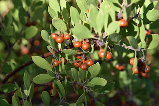
| Manzanita shrubs grow along the route |
little trek is surprisingly easy to find and mostly ignored in favor of its big-draw
neighbors. Located off Boynton Pass Road
in northwest Sedona not far from the hyper-popular Bear Mountain, Doe Mountain
and Fay Canyon trails, the dusty, deceivingly dull-looking Forest Road 152E provides
access to a quiet back country stroll below the western flanks of 6,541-foot
Bear Mountain.
 |
| The hike follows old roads and rugged paths |
follow FR 152E for 0.3-mile and turn left onto FR 9600.
 |
| A mesquite tree frames Bear Mountain views |
route curves through sunny rangeland just outside of Red Rock Secret Mountain
Wilderness in Coconino National Forest.
 |
| Looking north toward Loy Butte |
a half-mile of hiking on dirt roads, the route meets a fenced roundabout where
a gate at the west end signals the hike’s transition from road to path. To
protect wildlife, only non-motorized traffic is allowed beyond the gate. Off to the left, a conspicuous stand of
cottonwoods and a dilapidated corral marks the site of Robinson and Red Tanks,
important wildlife water sources.
 |
| The no-name trail welcomes hikers |
trail, which is part degrading two-track and part scrappy path, passes over and
through several drainage areas with wonderful views of 5,700-foot Loy Butte to the
north, the famous Cockscomb formation to southeast, the mountains around Jerome
and Cottonwood to the west and seldom seen geological layers of the back side
of Bear Mountain. Airy and wide open to the sky, this off-the-main-drag gem
delivers a healthy dose of refreshing isolation.
 |
| Part of the hike follows FR 9600 |
 |
| The unassuming trailhead |
gets more difficult to follow as it ducks into gullies and cacti-tangled
manzanita shrubs. Unless you’re dressed
in protective long pants and sleeves and willing do some searching to pick up
the trail beyond the scrubby barriers, make the tree-ringed clearing that sits outside
the quagmire the turnaround point for the hike.
 |
| Cockscomb (R) and Doe Mtn (L) seen from the trail |
LENGTH: 2.7
miles roundtrip
RATING:
easy
ELEVATION: 4,487 – 4,564 feet
GETTING
THERE:
From the
State Route 179/89A traffic circle in uptown Sedona, go 3.2 miles east (toward
Cottonwood) on SR 89A to Dry Creek Road. Turn right and continue 4.5 miles to
Boynton Pass Road, turn left, go 1.9 miles and park in the dirt turnout at
Forest Road 152E on the right. For reference, this is 0.7-mile past the Doe
Mountain/Bear Mountain trailhead. There are no fees.
Kommentare
Kommentar veröffentlichen