Transept Trail
TRANSEPT
TRAIL
Forming a
natural divide between State Route 179 and the hyper-busy trails that loop
around iconic Bell Rock in the Village of Oak Creek, the north-south running ridgeline
known as the Seven Warriors is home to a pair of trails known for their
edge-hugging exposure.
The Hiline Trail
that’s part of the Yavapai Vista Trail System, scoots along the ridgeline’s
eastern slopes while the newer Transept Trail traces the less congested western
side. There are several ways to access the user-created route that was adopted
by the forest service in 2018. The most direct way to is begin at the small
trailhead along Verde Valley School Road.
This less aggressive approach offers a more gradual, smoother gradient than
its east side counterpart as well as equally heady views. The first half-mile makes a steady but mild ascent through cypress-juniper
woodlands and jumbled drainages. At the 0.2-mile point, keep an eye out for the
Mayan Maiden rock formation that stands at the base of a mass of russet pinnacles
to the south. The conspicuous natural sculpture looks convincingly like an elegantly-
dressed woman emerging from the stone.
Beyond the
Mayan Maiden, the easy walk transitions into a more moderate haul defined by
slickrock passages and high-step climbs over crumbling sandstone shelves.
Although some slippery loose rock, tricky turns and short sections with stomach-churning
deep drop offs require extra effort and steady nerves, the payoff of hiking
close to the edge is unobstructed vistas of Cathedral Rock, House Mountain and
the flood plains of Oak Creek. The Transept
Trail ends at the 3.2-mile point where is connects with the Hiline Trail. From this
high point junction on the nose of a beveled rock jetty with 360-degree views, there
are several ways to extend the hike or make a long loop. Consult the forest service map for details.
LENGTH:
6.4 miles out-and-back
RATING: moderate-difficult
ELEVATION: 4,200 – 4,570 feet
GETTING
THERE:
From State
Route 179 in the Village of Oak Creek, go 2.1 miles west (left through the
traffic roundabout ) on Verde Valley School Road to the parking area on the left.
The trail begins across the road.
INFO &
MAP:
TRAIL
 |
| Many slick rock passages define the Transept Trail |
Forming a
natural divide between State Route 179 and the hyper-busy trails that loop
around iconic Bell Rock in the Village of Oak Creek, the north-south running ridgeline
known as the Seven Warriors is home to a pair of trails known for their
edge-hugging exposure.
 |
| Transept Trail traces the cliffs of the Seven Warriors ridge |
The Hiline Trail
that’s part of the Yavapai Vista Trail System, scoots along the ridgeline’s
eastern slopes while the newer Transept Trail traces the less congested western
side. There are several ways to access the user-created route that was adopted
by the forest service in 2018. The most direct way to is begin at the small
trailhead along Verde Valley School Road.
 |
| Mayan Maiden formation is a must-see feature along the trail |
This less aggressive approach offers a more gradual, smoother gradient than
its east side counterpart as well as equally heady views. The first half-mile makes a steady but mild ascent through cypress-juniper
woodlands and jumbled drainages. At the 0.2-mile point, keep an eye out for the
Mayan Maiden rock formation that stands at the base of a mass of russet pinnacles
to the south. The conspicuous natural sculpture looks convincingly like an elegantly-
dressed woman emerging from the stone.
 |
| Looking south on the Transept Trail |
 |
| Views of Cathedral Rock from the Transept Trail |
 |
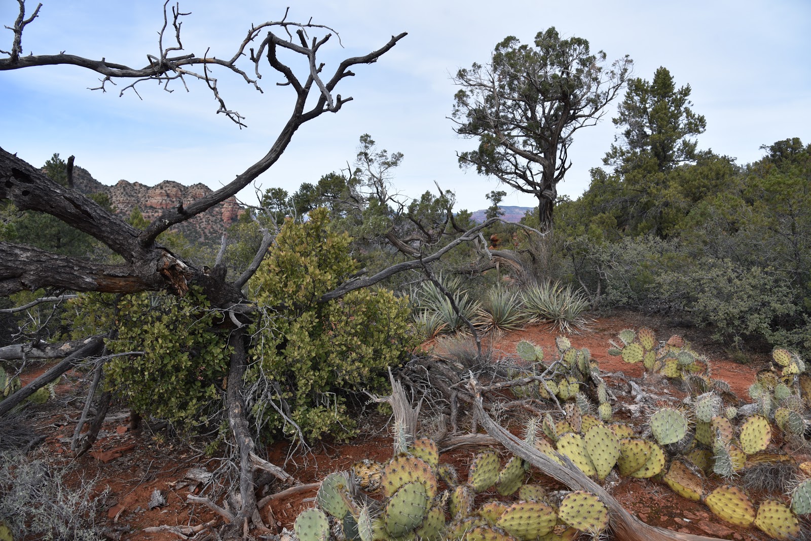
| Hardy agaves line the trail |
Beyond the
Mayan Maiden, the easy walk transitions into a more moderate haul defined by
slickrock passages and high-step climbs over crumbling sandstone shelves.
Although some slippery loose rock, tricky turns and short sections with stomach-churning
deep drop offs require extra effort and steady nerves, the payoff of hiking
close to the edge is unobstructed vistas of Cathedral Rock, House Mountain and
the flood plains of Oak Creek. The Transept
Trail ends at the 3.2-mile point where is connects with the Hiline Trail. From this
high point junction on the nose of a beveled rock jetty with 360-degree views, there
are several ways to extend the hike or make a long loop. Consult the forest service map for details.
 |
| Juniper trees shade the lower part of the trail |
 |
| High desert woodlands on Transept Trail |
 |
| Transept Trail is an adopted user-crated route |
LENGTH:
6.4 miles out-and-back
RATING: moderate-difficult
ELEVATION: 4,200 – 4,570 feet
GETTING
THERE:
From State
Route 179 in the Village of Oak Creek, go 2.1 miles west (left through the
traffic roundabout ) on Verde Valley School Road to the parking area on the left.
The trail begins across the road.
INFO &
MAP:


Kommentare
Kommentar veröffentlichen